Satellite imagery by ESRI shows extensive destruction at Khumujamba Leikai, Churachandpur.
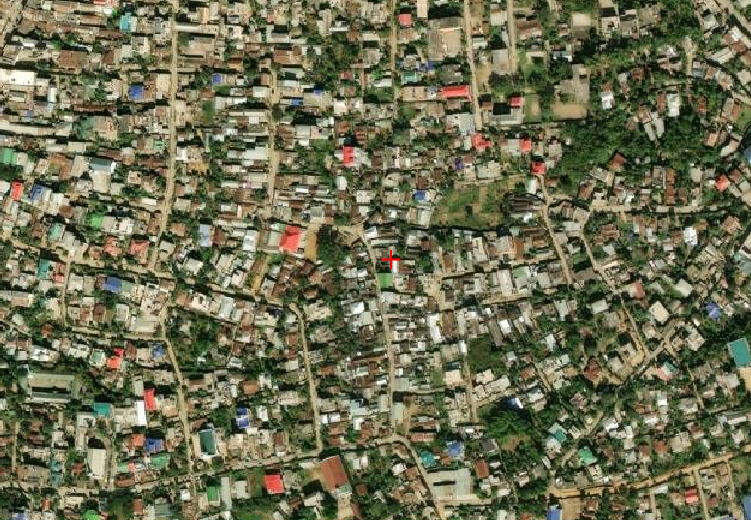 Image 1 (Prior to the crisis)
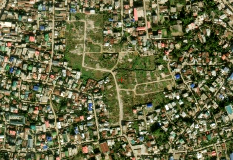 Image 2 (Sept. 2026)
The first image shows the state of the area before the crisis, while the second shows the present-day situation. Bulldozed settlements have been mostly reclaimed by vegetation growth.